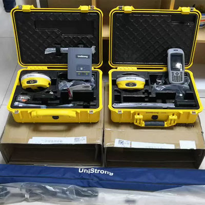
Brand Name: | Unistrong |
Model Number: | G970ii |
MOQ: | 1 piece |
Price: | $3,050.00 |
Payment Terms: | L/C, T/T |
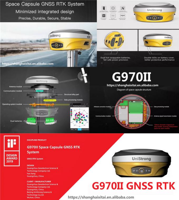
Unistrong G970II GPS Gnss Rtk Receiver Surveying Instrument
Product model | G970II | |
GNSS | Channels | 800 channels |
Satellite Signals | GPS: L1C/A,L1C,L1P,L2C,L2P,L5; GLONASS:G1P1,G1OC,G2OC,G2P2,G3OC BDS: B1I, B2I, B3I, B1C, B2a, B2b, ACEBOC; Galileo: E1BC, E5a, E5b, ALTBOC, E6 QZSS: L1C/A, L1C, L2C, L5, LEX; SBAS: L1, L5; IRNSS: L5; L-Band |
|
Accuracy |
Static | H: 2.5mm±1ppm,V: 5mm±1ppm |
RTK | H: 8mm±1ppm,V: 15mm±1ppm | |
DGNSS | <0.5m | |
ATLAS H10 | 8cm | |
Initialization Time |
8s | |
Initialization Reliable |
99.9% | |
System |
OS | Linux |
Memory | 8GB,support expandable MicroSD | |
Wi-Fi | 802.11 b/g/n | |
Bluetooth | V2.1+EDR/V4.1Dual, Class2 | |
E-Bubble | Support | |
IMU Tilt Survey | Fusion positioning, 400Hz refresh rate, 2cm (@60°Tilt degree) | |
Audio | support TTS audio broadcast | |
Datalink | UHF radio | T/Rx Internal Radio, 1W/2W adjustable, 410-470MHz |
Radio protocol | Support GeoTalk, SATEL, PCC-GMSK, TrimTalk, TrimMark, South, Hi-Target | |
Network | 4G-LTE, TE-SCDMA, CDMA(EVDO 2000), WCDMA, GSM(GPRS) | |
Reference outputs |
RTCM2.3, RTCM3.2, CMR,CMR+,ROX | |
Physical | Interface | 1*TNC Radio Antenna, 1*5Pin(Power & RS232),1*7Pin (USB 81 RS232) |
Button | 1 Power Button | |
Indication Light | 4 Indication Lights | |
Size | Φ156mm×H76mm | |
Weight | 1.2kg | |
Power supply | Battery capacity | 7.2V, 24.5Wh(standard two batteries) |
Life Timer | Static Survey: 15 hours, Rover RTK survey: 12h | |
External power source |
DC 9-18V, with overvoltage protection | |
Environment | Work Temperature | -35ºC~+65ºC |
Storage Temperature |
-55ºC~+85ºC | |
Waterproof & dustproof |
IP68 | |
Humidity | 100% anti-condensation |
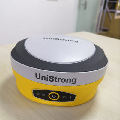
REAL PRODUCT PHOTO